Have you ever wondered how road maps have evolved over the centuries? As avid road trip enthusiasts, we find the history of maps just as fascinating as the journeys they guide us on. So, buckle up and join us for a ride through the evolution of road maps and where we are today!
Ancient beginnings: Road maps date back to ancient civilizations like the Babylonians, Greeks, and Romans. Early Roman maps, or itineraria, were simple and focused on routes, distances, and landmarks. But let's face it, they wouldn't have helped much with today's road trips!
Medieval and Renaissance breakthroughs: Maps in the medieval era were mainly for religious or noble use. However, the Renaissance brought about a cartographic revival. Road maps like the 13th-century Tabula Peutingeriana showcased the Roman Empire's extensive road network.
Exploration sparks progress: As European explorers set sail in the 15th and 16th centuries, the demand for accurate maps grew. Mapmakers, using explorers' accounts, refined road maps. Pioneers like John Ogilby produced strip maps in the 17th century that displayed roads, distances, and landmarks.
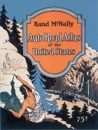
Gearing up for road trips: With automobiles hitting the scene in the late 19th and early 20th centuries, road maps flourished. Automobile clubs, oil companies, and government agencies produced detailed maps for eager travelers. Rand McNally's 1924 Road Atlas made maps accessible to everyone.
Digital revolution: The late 20th and early 21st centuries saw a shift toward digital cartography. It all began with routes printed from MapQuest and evolved into Geographic Information Systems (GIS) and Global Positioning Systems (GPS). This eventually paved the way for accurate, dynamic digital maps, real-time traffic updates, and efficient route planning.
Present day: Today, we're spoiled for choice with digital road map platforms like Google Maps, Waze, and Apple Maps. They offer satellite imagery, street views, 3D mapping, and voice-guided navigation, right at our fingertips!
The evolution of road maps is a testament to human ingenuity and our love for exploration. As technology advances, we can only imagine how road maps will continue to transform. But no matter how they change, one thing remains the same: Kunes Auto & RV Group is here to help you make the most of your road trip adventures. Happy driving!


